The first time that I rode through in August of 2007, the western stretch of this road was a wondrous piece of pavement with fresh, racetrack-smooth pavement that was to die for even in the wet.
Then the paving stopped. And it became an adventure road. It was wet, gnarly, bumpy, frost-heavy, and oh yes, highly twisty.
With either a fresh coat of pavement or dry weather, Oregon 202 would’ve been highly enjoyable. As it was, between the damp weather and the logging trucks on Monday morning, it was very nerve-wracking.
Riding out of the south end of Astoria Oregon, one easily finds oneself on this old forest highway. It starts on the south side of Astoria where US101 splits off to the right and crosses the Youngs Bay Bridge. Once you get out of the Astoria area, there’s little to nothing for services. Make sure that you’re fed, fueled, and hydrated before leaving town.
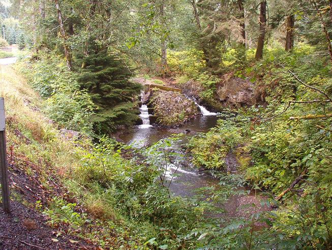
It’s not rather unexpected in this particular damp part of Oregon, but this road has a couple of nice waterfalls.
The small waterfalls along the roadway are rather pretty and a nice spot to rest and stretch. This one, Barth Falls, along the Klatskanie River is only a drop of a few feet but has an interesting little fish ladder to the left.
Much to my surprise and even though it looms large on my maps, the town of Jewell isn’t really a town but rather a spot where the farmhouses are a little closer together. It’s very easy to miss the turn down Fishhawk Falls Highway, that is if you’re heading back to 101. There’s also no services there, so you’re out of luck until you get to Mist or back to 101.
If you’re heading back to Portland, you might was well stay on 202 until you meet Oregon 47. From there you can pick any number of excellent backroads that will take you back to the big city.
- Towns: Astoria, Jewell, Mist
- Length: 43
- Counties: Clatsop, Columbia
Garmin GPX format file for Oregon Route 202
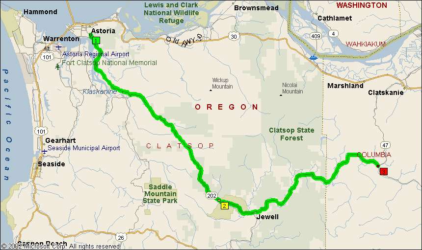
Overview Map:
Google Map: