Most of the road that you see below is only marginally a “motorcycle road”. In the summer, it’s hot and straight and not generally much fun throughout its length. Most riders could take it or leave and grudgingly acknowledge that it’s better than slogging up Interstate 5.
But I also said “most of the road”. Right smack in the middle of this highway, straddling the Washington / Oregon border you’ll find an amazing piece of pavement called the Rattlesnake Grade. When you mention this to any rider who’s done this twisty piece of paved paradise, their face will light up with an appropriately beatific smile.
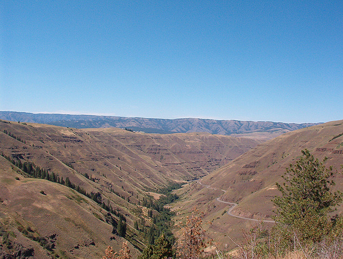
If you’ve ever seen my review of the Spiral Highway, that’s pretty much what you can except to see out on the Rattlesnake Grade. It twists back and forth for miles to traverse the elevation change of the Rattlesnake Grade. The primary difference is that there’s no nearby town for this road. There’s nothing much else to do expect ride this road over and over until you get low on gas and have to slog back in to Joseph, OR (40 miles) or Asotin, WA (25 miles) to fill your tank.
View of Oregon 3 / Washington 129 near the border:
Up near Asotin, you get another great round of sweepers.
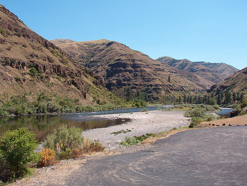
Right up on the Snake River is a moderately large community of Asotin. It’s backed by a steep ridge that provides for an excellent set of twisties that climbs 840 feet in under 4 miles. Quite nearly as steep as the Spiral Highway.
The view from the top is pretty spectacular, but don’t let it distract you from the next corner. The corners are also quite nearly as good as the Spiral Highway.
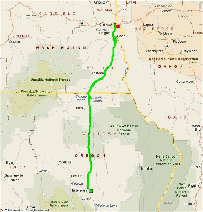
- Road Name: Washington State Route 129/Oregon Route 3
- Counties: Asotin, Wallowa
- Length: 85
- Towns: Anatone (WA), Appleton (OR), Asotin (WA), Clarkston (WA), Enterprise (OR), Flora (OR)
Overview Map:
Google Map: