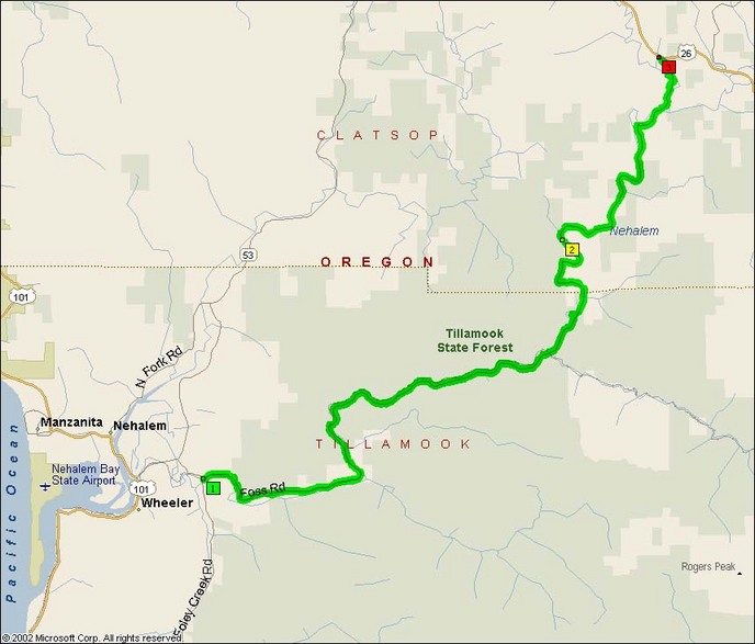
This road follows the Nehalem River out through the Cascade Range out to Nehalem Bay near Manzanita.
While I’ve never had an opportunity to ride this road myself, I’ve been told there are significant sections of the roadway that are not merely unpaved but are dirt 2-track trails.
Note: This road is known as Foss Road at the western junction where it meets US101.
- Road Name: Foss Road / Lower Nehalem Road
- Counties: Clatsop, Tillamook
- Length: 27
- Towns: Batterson, Blyvbach, Elsie, Foss, Helloff, Lukarilla, Lynnbrook, Maples, Nehalem Falls, Rector, Salmonberry, Snark, Wakefield
Overview Map:
Google Map: