Note: During the autumn of 2020, this area suffered severely from the wildfires. I have not revisited this area, and as of October 2020 some of these areas are still closed to travel.
This road is somewhat “schizophrenic” in the modern parlance. Every few miles you’ve suddenly got a completely different kind of road in front of you. While I waus staying in Portland with some old and new friends, I decided to take a weekend jaunt out into the Oregon Cascades to see how far I got before I hit snow. Perhaps it’s no surprise to longtime Portland residents, but I didn’t hit any snow on that weekend in May and instead got to ride a nice little highway that takes you well up into the Cascade foothills to Ripplebrook Ranger Station.
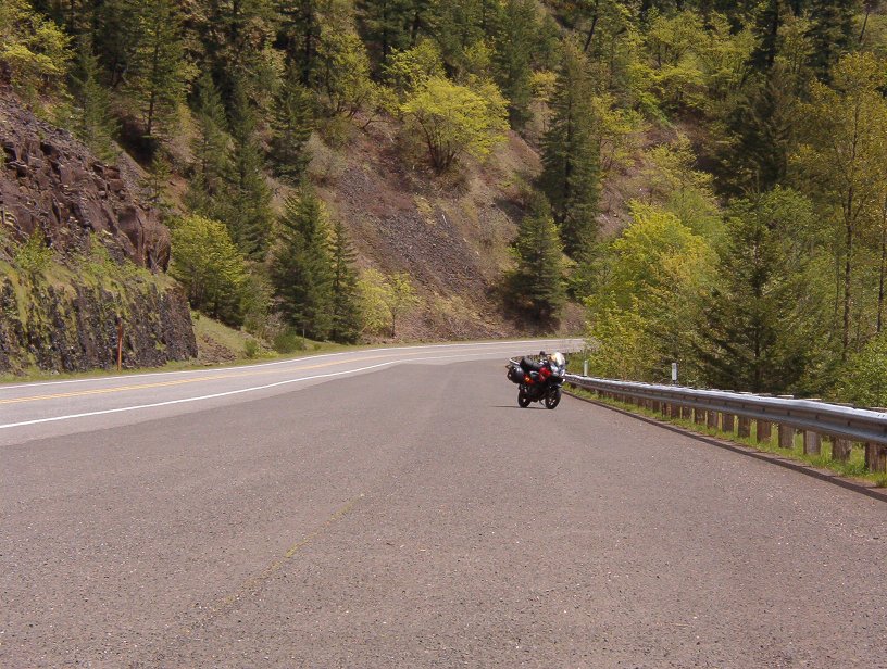
Sweeper along the Clackamas River
And yes, schizophrenic really is the word I thought of. It starts out in the valley as a 4-lane slab, then quickly switches to twisty 2-lane before easing out into sweeper than then slab again. Once you get up into the forest, you again get some wonderful high-speed sweepers (55 mph limit, please) before the mountains fully close in on the last 5 miles of truly twisty pavement.
Intriguing it was, and I certainly understand why the local seem to enjoy riding it so much as well. It was still somewhat early in the season, but I saw a number of sportbike groups blowing the dust and the rust of their riding skills that morning in those sweet sweepers.
RoadsNW user Spencer said the following about this road:
I have been on this road more than once and it is beautiful. The corners are banked well and the road is well maintained. There is little to no auto traffic but depending on the day you may see many bikes having fun on this road too. You can actually travel all the way to Detroit Lake where you can get gas and head back. My recommendation is to get gas in Estacada before heading up the hill and into the wilderness. The first climb is steep and at the top you will want to pull to the side and take in the view as it is amazing. When you get back on your bike you will have a long downhill double lane road for a bit that is just asking to be driven. The best part about this whole trip is that I have never seen any cops and have been told they do not patrol the 224 often. Oh and last but not least the Upper Clack river is a sight to be seen, a true wild river. Have fun and maybe I will see you there!!
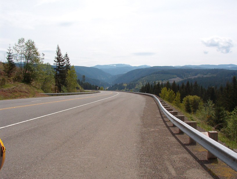
Long downhill run through the river valley
Do watch out for some of the little towns on this road. They’re quite serious about their 25mph speed limits and brook no nonsense. Also to watch out for are the deer and the elk. I sighted more than one carcass along the road. Hitting an elk is no joke.
There’s a selection of gas stations in Estacada for the peanut tank bikes, and a number of eating establishments. There’s also a small motorcycle & ATV parts & accessories shop in downtown Estacada. They don’t appear to sell a particular brand, but they apparently have a service bay for repairs & tire changes.
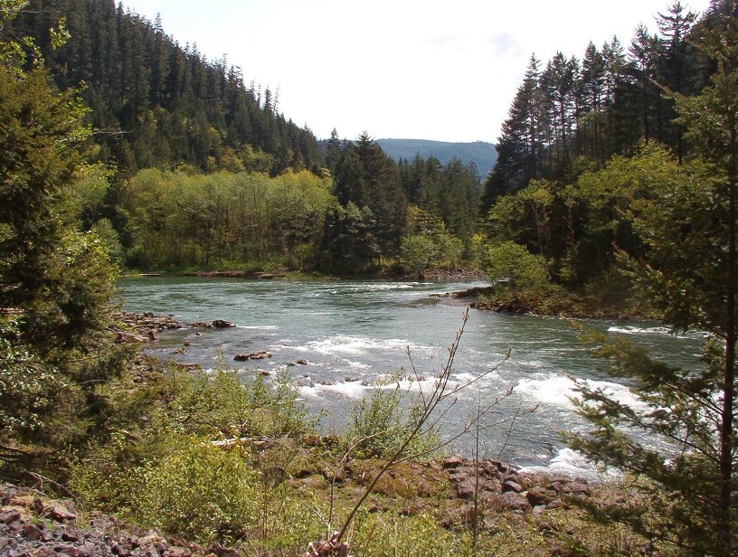
Clackamas River bend
If you’re into rafting, this river is also quite the treat. I saw no fewer than 3 rafting groups operating along the upper stretch of the river and the whitewater on this river is reputed to be rather fun.
An anonymous poster to our website indicated that there’s a lot of tourist traffic on this road now. Perhaps like many Cascade Range highways, this is one that should be ridden on the weekdays for best results.
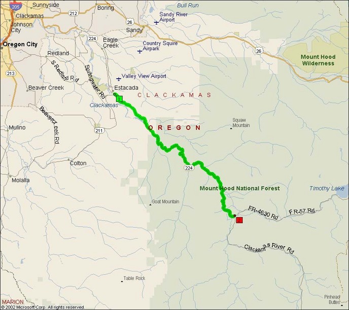
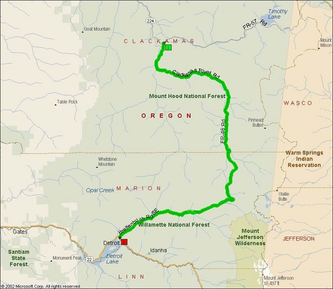
- Road Name: Oregon Route 224 (‘Clackamas Highway’) & FS 46 Clackamas River Road
- Counties: Clackamas
- Length: 81
- Towns: Barton, Breitenbush, Carver, Clackamas, Detroit, Eagle Creek, Estacada, Faraday, Ripplebrook, Three Lynx, Whitewater
Oregon Route 224:
Forest Service Road 46 / Clackamas River Road:
Google Map for Oregon 224 & Willamette FS 46: